 |
|
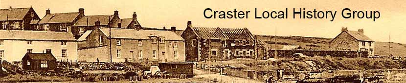
Archway - Tower Bank |
Craster in World War TwoAlthough it would be easy to regard Craster as a distant backwater in the context of WW2, there are many reminders of the war in Craster and its surrounds. Driving into Craster, the pill box at the bottom of Tower Bank is the first example of the way that the war made its presence felt in this area.
In fact, this is only one of several pill boxes that are to be found around Craster. The reason for their presence is the very real fear at the time that the beaches and harbours of North Northumberland may become landing sites for the invasion of Britain from Norway. Locals remember a military roadblock on the road into Craster close to the pill box, but all traces of this have now gone. This consisted two large concrete blocks on either side of the road restricting the width of the road to that of one vehicle. Dennis Dawson's father had the job of lighting the two oil lamps that marked the obstruction out at night time. In the harbour itself, three large concrete cubes are still to be found on the foreshore. Their role was to impede the movement of vehicles. The best examples in Northumberland are found to the north and south of the mainland end of the causeway to Holy Island. Closer examples may be found on the beach to the north of Bamburgh Castle. Those placed along Embleton beach have either been removed or covered in sand.
|


|
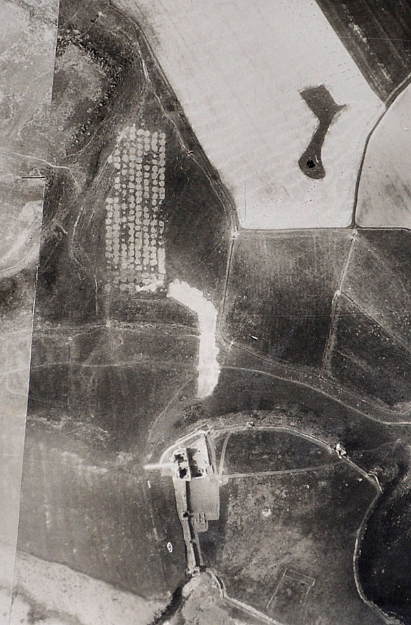
The larger photograph is made up of many separate images, cut and stuck together to make a coherent whole by Sir Ivan and Lady Sutherland, which extends from Craster to High Newton and from the sea to inland of Embleton. One of the images carries the following number, 106G/UK.24June'45.F/202//54.... Unfortunately the end of the number is covered by another part of the image and may continue for an unknown number of digits.
The photograph was taken after the individual mines in the field had been exploded and Lady Sutherland remembers a herd of cows being put into the area to complete the job if necessary! Happily, Lady Sutherland remembers that no further explosions were triggered.
 |
Home Programme Membership Archive War Memorials History Walk Miscellanea Links Contact Us